 a tribute to the Guanches
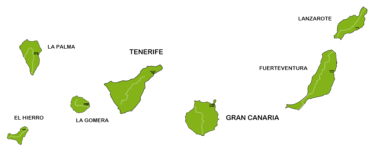
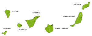
7 island- 496 Km
The Camino del Guanche
The hiking Adventure GR 131The Camino del Guanche
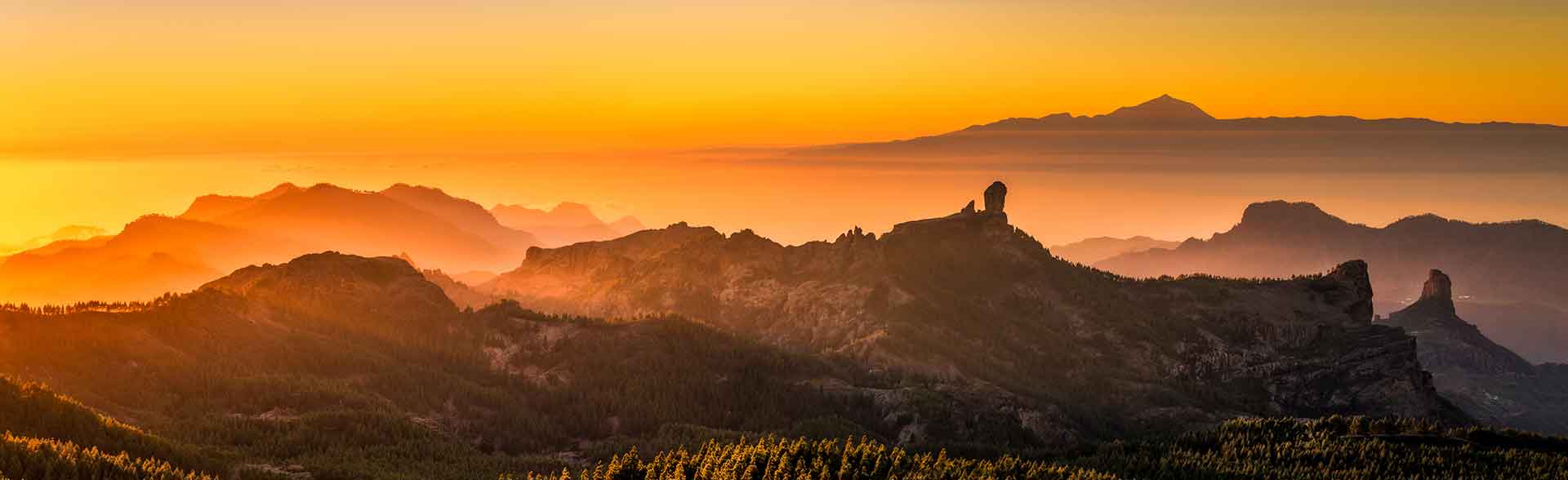
is a tribute to the ancient inhabitants of the Canary Islands. A population of stocky inhabitants of Berber origin who walked the islands on foot, crossing them from side to side as they led their herds to the best pastures. They inhabited the islands about 1800 years ago and were colonised and enslaved after the arrival of the Spanish. On each island they developed in different ways, which is why they have been given different names depending on the island: Benahoritas on La Palma; Bimbaches on El Hierro; Guanches on Tenerife and La Gomera…

But their way of life and customs were similar: they lived by shepherding, berry picking and local fishing. They lived in caves and did not know how to use metals. They did not sail, so there was no interaction between the tribes on the different islands.
In their journeys on foot with the herds, they used paths and trails previously marked by the animals. They used these trails to reach places suitable for grazing, crossed deep ravines and maintained relations with the various menceyatos of each island.
Today these trails are for the enjoyment of contemporary hikers and have technical names, such as GR 130 or GR 131. But we, in homage to those hardened hikers of the past, prefer to call them…
Camino del Guanche
from island to island – stage by stage

Lanzarote GR 131
· ![]() 74,8 km ·
74,8 km · ![]() in 5 stages ·
in 5 stages ·
An island that reflects its volcanic dimension in its purest form. Dark and rough at first sight but full of contrasts and magical colours. A different island that never ceases to surprise. Walking along its paths means penetrating into the soul of Lanzarote and enjoying the landscapes only available on the Camino del Guanche.
▸ Include
![]() |
| ![]() |
| ![]() |
| ![]()


Fuerteventura GR 131
· ![]() 98,1 km ·
98,1 km · ![]() in 6 stages ·
in 6 stages ·
Fuerteventura’s antiquity has redrawn its outline. It is the largest of the Canary Islands, from end to end. The modulation of its mountains and its soft shapes captivate at first sight. Soft landscapes, rounded shapes and light colours, with a spectacular turquoise sea and white beaches as a backdrop. Along the Camino del Guanche you will enjoy its open views over a landscape reduced to minimalism.
▸ Include
![]() |
| ![]() |
| ![]() |
| ![]()


Gran Canaria GR 131
· ![]() 76,8 km ·
76,8 km · ![]() in 5 stages ·
in 5 stages ·
Gran Canaria is the administrative centre of the province of Gran Canaria and has autonomous government institutions shared with Tenerife for the whole of the islands. In the south, tourist development is extensive. But its inland area is surprising for its rural character, which has remained untouched by the developmentalism of the last 40 years. The Camino del Guanche runs through almost virgin landscapes, in an island whose landscape diversity and extraordinary nature will not leave you indifferent.
▸ Include
![]() |
| ![]() |
| ![]() |
| ![]()


Camino de Santiago
· ![]() 65,1 km ·
65,1 km · ![]() in 4 stages ·
in 4 stages ·
The Camino de Santiago de Gran Canaria is more than a hiking route. The Camino is a journey with yourself, with friends, with family and sometimes with strangers. The real Camino is the one you make with an open heart, willing to cross the whole island from south to north.
▸ Include
![]() |
| ![]() |
| ![]() |
| ![]()


Tenerife GR 131
· ![]() 102 km ·
102 km · ![]() in 6 stages ·
in 6 stages ·
At 3,715 metres, the island of Tenerife is the highest island in the archipelago and has the highest peak in Spain: Mount Teide. It is a large and very mountainous island, with splendid pine forests and recent volcanic areas. A jewel for hiking enthusiasts. The Camino del Guanche runs along the GR 131, crossing the island from one side to the other through Monte de La Esperanza, Las Cañadas del Teide and the natural monuments of the south. A challenge in 6 spectacular stages, walking from point to point.
▸ Include
![]() |
| ![]() |
| ![]() |
| ![]()


La Gomera GR 131
· ![]() 40,1 km ·
40,1 km · ![]() in 3 | 4 stages ·
in 3 | 4 stages ·
La Gomera is a small island that can be reached on foot. Its splendid forests of lush laurisilva spread throughout the central part, projecting a mantle of clouds that provides them with permanent humidity. The island is lush green and jungle-like, with monolithic basalt rocks standing in the middle of the landscape. The GR 131 starts in San Sebastián and crosses the whole island from east to west in 3 stages, until it reaches Vallehermoso.
▸ Include
![]() |
| ![]() |
| ![]() |
| ![]()


La Gomera Camino Natural
· ![]() 89,8 km ·
89,8 km · ![]() in 6 stages ·
in 6 stages ·
A loop itinerary, with 6 stages along the GR 131 and Camino Natural from La Gomera. A demanding walk for experienced hikers. 6 stages that intensely discover all the facets of this small pearl in the Atlantic. Walking from east to west, crossing the lush forests of the best preserved laurel forest of the Canary Islands and ending in Puerto Santiago, in the south of La Gomera.
▸ Include
![]() |
| ![]() |
| ![]() |
| ![]()


La Palma GR 131
· ![]() 66,3 km ·
66,3 km · ![]() in 3 or 4 stages ·
in 3 or 4 stages ·
The Isla Bonita lives up to its name, offering hikers its enormous diversity of landscapes, splendid views and pure nature. With volcanoes as recent as Tajogaite, La Palma is a young island with extensive volcanic areas in the south. In its centre, the huge crater of La Caldera de Taburiente shows a unique depression, a product of erosion. The peaks of La Palma, in the north, reach 2,426 metres and allow you to walk around La Caldera along the GR 131. This path, which we call Camino del Guanche, emulates the routes taken by the ancient aborigines when they transhumed their livestock. A route that can be tackled in 3 or 4 stages that will not leave you indifferent.
▸ Include
![]() |
| ![]() |
| ![]() |
| ![]()


El Hierro GR 131
· ![]() 38,4 km ·
38,4 km · ![]() in 3 stages ·
in 3 stages ·
It is the smallest in the Canary Islands. Its route along the GR 131 ends at the westernmost point of the Canary Islands: the Faro de Orchilla lighthouse. The 3 stages of the Camino del Guanche cross its ridges through almost virgin landscapes. A route that starts and ends by the sea, from Tamaduste to the lighthouse of Orchilla. On this route you will enjoy superb views over the different islands of the archipelago.
▸ Include
![]() |
| ![]() |
| ![]() |
| ![]()


El Hierro Camino Natural
· ![]() 83,8 km ·
83,8 km · ![]() in 5 stages ·
in 5 stages ·
A loop itinerary, with 3 stages along the Camino Natural de El Hierro and 2 final stages along the GR 131. A demanding walk for experienced hikers. 5 stages that intensely discover every highlight of this small pearl in the Atlantic. Walking from west to east along the southern flank of El Hierro and from east to west along the northern side of the island.
▸ Include
![]() |
| ![]() |
| ![]() |
| ![]()

¿Questions?
I’m hable to help you, to solve doubts and to create your next hiking adventure !

connect several islands?
If you are thinking of doing the Camino del Guanche on more than two islands, you will save on ferry transfers or inter-island flights.
We will organize for you free of charge the ferry or flight connections between contiguous islands.
REQUEST MORE INFORMATION
Frequently Asked Questions
What is the Camino del Guanche?
The Camino del Guanche ("Way of the Guanche") is the name we at Natour use to pay tribute to the ancient inhabitants of the Canary Islands as we walk the GR 131, the long-distance trail that crosses all 7 islands of the archipelago with 496 km of paths in total. The Canarian aborigines — of Berber origin — crossed their islands on foot, driving their herds towards the best pastures along trails that today, centuries later, serve the enjoyment of modern walkers under technical names such as GR 130 or GR 131. We prefer to call it the Camino del Guanche.
Who were the Guanches?
They were the inhabitants of the Canary Islands around 1,800 years ago: a people of Berber origin who lived from herding, berry gathering and inshore fishing, dwelt in caves and knew nothing of metalworking. As they did not sail, the tribes of each island developed in isolation, which is why they go by different names: Benahoritas on La Palma, Bimbaches on El Hierro, Guanches on Tenerife and La Gomera... After the arrival of the Spanish they were colonised and enslaved. The Camino del Guanche retraces their transhumant journeys across the summits of each island.
Can the Camino del Guanche be walked on all 7 islands? How many stages does each one have?
Yes, we organise the Camino del Guanche island by island, stage by stage, on all 7 islands: Lanzarote (74.8 km in 5 stages), Fuerteventura (98.1 km in 6 stages), Gran Canaria (76.8 km in 5 stages), Tenerife (102 km in 6 stages), La Gomera (40.1 km in 3 stages), La Palma (66.3 km in 3 or 4 stages) and El Hierro (38.4 km in 3 stages). We also offer variants such as the Camino de Santiago of Gran Canaria (65.1 km in 4 stages), the La Gomera Nature Trail (89.8 km in 6 stages) and the El Hierro Nature Trail loop (83.8 km in 5 stages).
What do the packages for each island include?
All our Camino del Guanche programmes include accommodation with breakfast (dinner is at your own arrangement), luggage transfers by taxi from one accommodation to the next, support transfers by taxi to take you to the start of the stage or back to your accommodation whenever the logistics require it, and the maps, descriptions and GPX tracks of each stage for GPS navigation. The cost of all taxis is already included in the package price: you pay nothing extra. Flights to the Canary Islands are not included.
How long is each stage and what elevation gain should I expect?
It depends on each island, but on average each stage is around 14 km. As for elevation, the eastern islands (Lanzarote, Fuerteventura) have gentler terrain, with rolling paths and moderate climbs. The western islands, on the other hand, are far more rugged: on La Palma and Tenerife the trail climbs above 2,000 metres, and the GR 131 of La Palma, which skirts the Caldera de Taburiente along its crests up to 2,426 m, is our most demanding programme (difficulty ▲▲▲▲▲).
Which island is the best one to start with?
It depends on your experience and the kind of scenery you're after. For a first taste, La Gomera (3 stages through laurel forests) or El Hierro (3 stages along ridgelines with views over the archipelago) are perfect thanks to their short format. Lanzarote and Fuerteventura offer gentler stages amid volcanic landscapes and beaches. Tenerife is the big challenge: 6 stages crossing the island through Las Cañadas del Teide. And La Palma, the "Isla Bonita", packs the high mountains of the Canaries into 3–4 spectacular and demanding stages around the Caldera de Taburiente.
Can I combine several islands in a single trip?
Yes, and it's a very popular formula. The islands are connected by sea (ferry) and by air (inter-island flights of around 30 minutes), and we can arrange bookings for both, although their cost is charged separately. What's more, if you walk the Camino del Guanche combining more than two islands, we organise the connections between neighbouring islands — by sea or air — free of charge, saving you the management fees for those connections.
What weather can I expect along the routes?
The Canary Islands enjoy spring-like weather almost all year round, but that spring feels very different on the coast and on the summits. A practical rule of thumb: for every 100 metres of altitude, the temperature drops by roughly 1 degree, although factors such as calima (Saharan haze), wind or cloud cover can alter it. In practice, at 2,000 metres (common on Tenerife and La Palma) you need warm clothing as well as sun protection, just in case. Layering is the best strategy.
Will I find water and food along the stages?
The Camino del Guanche runs along the central mountain ranges of each island, crossing their summit areas, where springs and supply points are scarce. We recommend carrying a minimum of 1.5 litres of water per person on each stage. As for food, depending on the island and the stage you may come across guachinches and bars for lunch, but that's not always the case: on some stages it's essential to pack a picnic to take with you.
What is a "guachinche"?
One of the most beloved gastronomic institutions of the Canary Islands: a home-cooking eatery, usually run by a family in which the lady of the house cooks and her husband looks after the guests. Coming across one on the trail is a guarantee of hearty, authentic food at a good price: the best reward after a stage across the summits.
Is the GR 131 waymarked? How do I find my way?
The GR 131 is an officially certified long-distance trail, waymarked with the classic white-and-red GR stripes on all 7 islands. In addition, each programme provides you with maps, detailed stage descriptions and GPX tracks to follow the route by GPS on your mobile device, so you can walk with complete peace of mind even on the loneliest summit stretches.
How do the luggage and passenger transfers work?
We move your luggage by taxi from one accommodation to the next, so you walk with only a light daypack. On certain stages there are also support transfers that take you back to your accommodation at the end of the day, or bring you to the start of the stage in the morning. All these transfers are always made by taxi and their cost is fully included in the package price.
Is this a guided trip or do I walk on my own?
It's independent (self-guided) hiking: you walk at your own pace, with no groups or fixed schedules, while we take care of all the logistics — accommodation, transfers and route documentation. Our long experience organising hotel-to-hotel trips with luggage transfers — we are a Canarian agency, based in Santa Cruz de La Palma — allows us to guarantee excellent service and personalised attention, adapting to your preferences.
Do I get any certification for completing the Camino del Guanche?
Yes. On completing your Camino del Guanche you'll receive a T-shirt with the trail's logo and the name of the island you've walked: your accreditation as a modern-day walker following in the footsteps of the ancient Guanches. And if you go on to collect islands, each one comes with its own T-shirt.
When is the best time of year to walk the Camino del Guanche?
Practically any time: the spring-like climate of the Canary Islands makes walking possible all year round, and that's one of the archipelago's great advantages over other European hiking destinations. Winter is ideal for escaping the continental cold (with caution on the summits of Tenerife and La Palma, where temperatures can be low and there may even be snow), and summer is more manageable than you'd think thanks to the trade winds, especially on the western islands and at higher altitudes. Spring and autumn offer the perfect balance on every island.