
GR 131 on La Palma
The Walking Stick route, along the GR 131, has a total distance of 66.3 km with ascents of almost 4,500 metres and descents of more than 4,000 metres. It is therefore considered a challenge even for experienced hikers. If you have already booked your accommodation and you feel like facing this challenge, we propose you to walk it in 3 stages. Each day we will organise transfers to and from your hotel or place of accommodation. You will also get useful information for each stage, as well as the GPX tracks. And at all times you will have us at hand for any questions or problems that may arise along the way. Join the challenge !
GR131 on La Palma : the challenge in 3 stages
3 stages to hike the GR 131 on La Palma independently. We organize for you all necessary transfers.
1st stage: from the Salinas to the Refugio el Pilar
2nd stage: from Refugio el Pilar to Pico de la Cruz
3rd stage: from Pico de la Cruz to Puerto de Tazacorte
Perfectly marked trails
transfers included from your accommodation (round trip at each stage)

Hiking ON YOUR OWN
any date is possible:
What does this program include?
- Information material – descriptive brochures for each stage
- GPX Tracs– to follow your tourss with your mobile device
- Traslados en taxi – all necessary transfers for each route
- Support 24h – we keep permanently in touch with you throughout your stay to solve any problem or doubt you may have
Any arrival date is possible
You decide your travel dates and programme start. All you have to do is let us know your accommodation.
WARNING: The route in stages along the GR131 requires good physical condition and walking safety and is only suitable for regular walkers.
IDEA: Interspersing a rest day between each stage can help you to successfully complete this programme.

Transfers from Santa Cruz or from Cancajos
Self-guided hiking route
Any date is possible


GR131 on La Palma
The Walking Stick route, in three stages. Along the GR131 you will follow the Ruta de Los Volcanes in reverse, cross the central ridge of La Palma (wrongly called Cumbre Nueva) and climb up to Roque de Los Muchachos, before starting the steep descent to Puerto de Tazacorte.
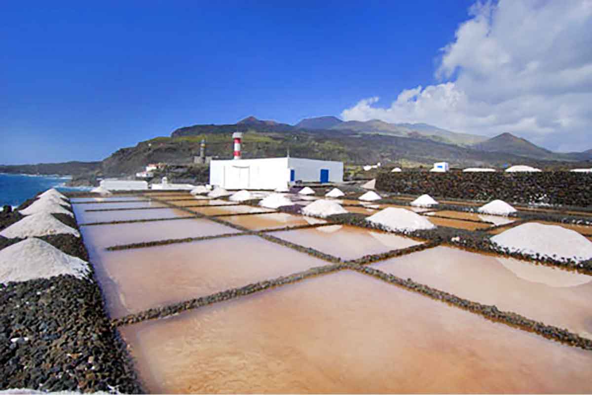
- 1st stage: from the saltpans in the south to Refugio del Pilar
- 2nd stage: from Refugio del Pilar to Pico de La Cruz
- 3th stage: from RPico de La Cruz to Puerto de Tazacorte
Walking distance in total: 66,3 Km.
Don’t miss out on the spectacular GR131 of La Palma! We are waiting for you.
What customers say about us?
Your accommodation is already booked?
then have a look to our transfers for self-guided WALKING TOURS
…or our guided WALKING TOURS, with daily departures from all hotel and well organised transfers
-
Destination
-
Included
Transfers by taxi and regular busLiability and accidents insuranceMaps and printed descriptions -
Not Included
4WD transferaccess permissionsAperitivoArrival transferBebidasBed & Breakfast accommodationbeveragesBicycle rentalBus transfersCable-carCar RentalCourtesy lunchfield telescopeGuideHalf board accommodationHAVEN hanging tentin/out Airport transferLocal flights + FerryLuggage transferLunchsnackTastingTransfer by shipTraslado en 4x4Two nights in a hotel
Our gallery
Pictures from the tours
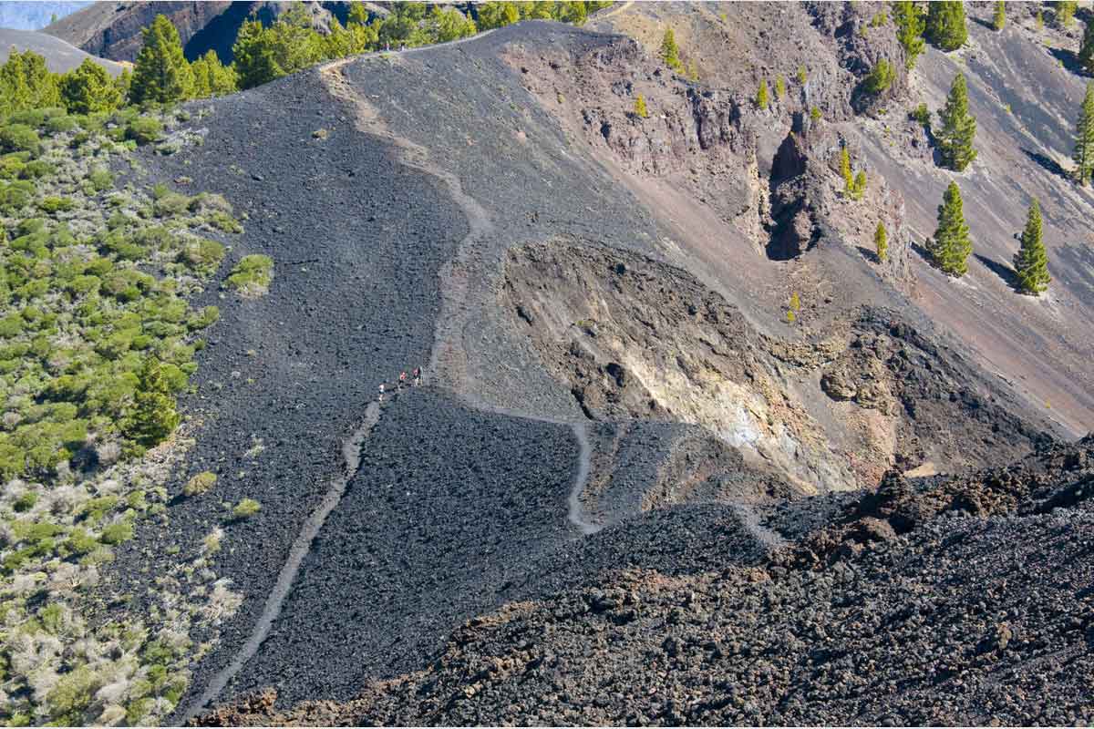

1st stage
 Salinas to Refugio el Pilar
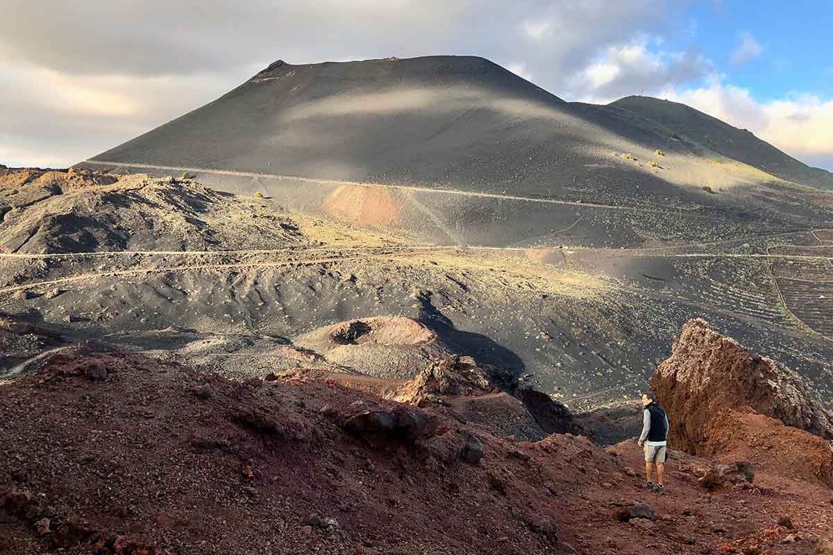
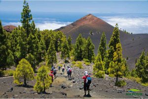
Early in the morning our driver will take you to the southern tip of La Palma. Next to the lighthouse of Fuencaliente the GR131 starts a permanent ascent. Soon you will cross the Teneguía Volcano (eruption in 1971) and the San Antonio Volcano, before reaching the village of Fuencaliente, 650 metres above sea level. The GR131 route continues its relentless ascent to Volcán Martín, 1500 metres above the sea. A little further on are the twin craters of Las Deseadas, at the highest point of the Ruta de Los Volcanes (1949 metres above sea level). After enjoying some superb panoramic views, we start a gentle descent towards Refugio del Pilar (1450 metres above sea level), where today's stage ends. Our driver will be waiting for you to return to the hotel in Santa Cruz de La Palma.
 23,1 km | +2140 m / -684 m
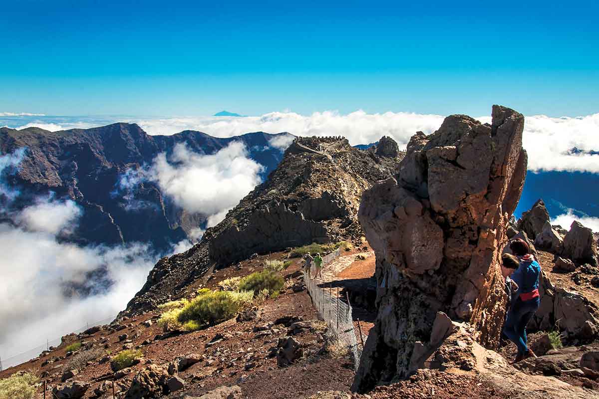
2nd stage
 Refugio el Pilar to Pico de la Cruz
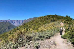
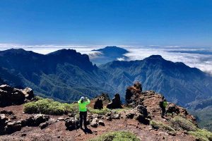
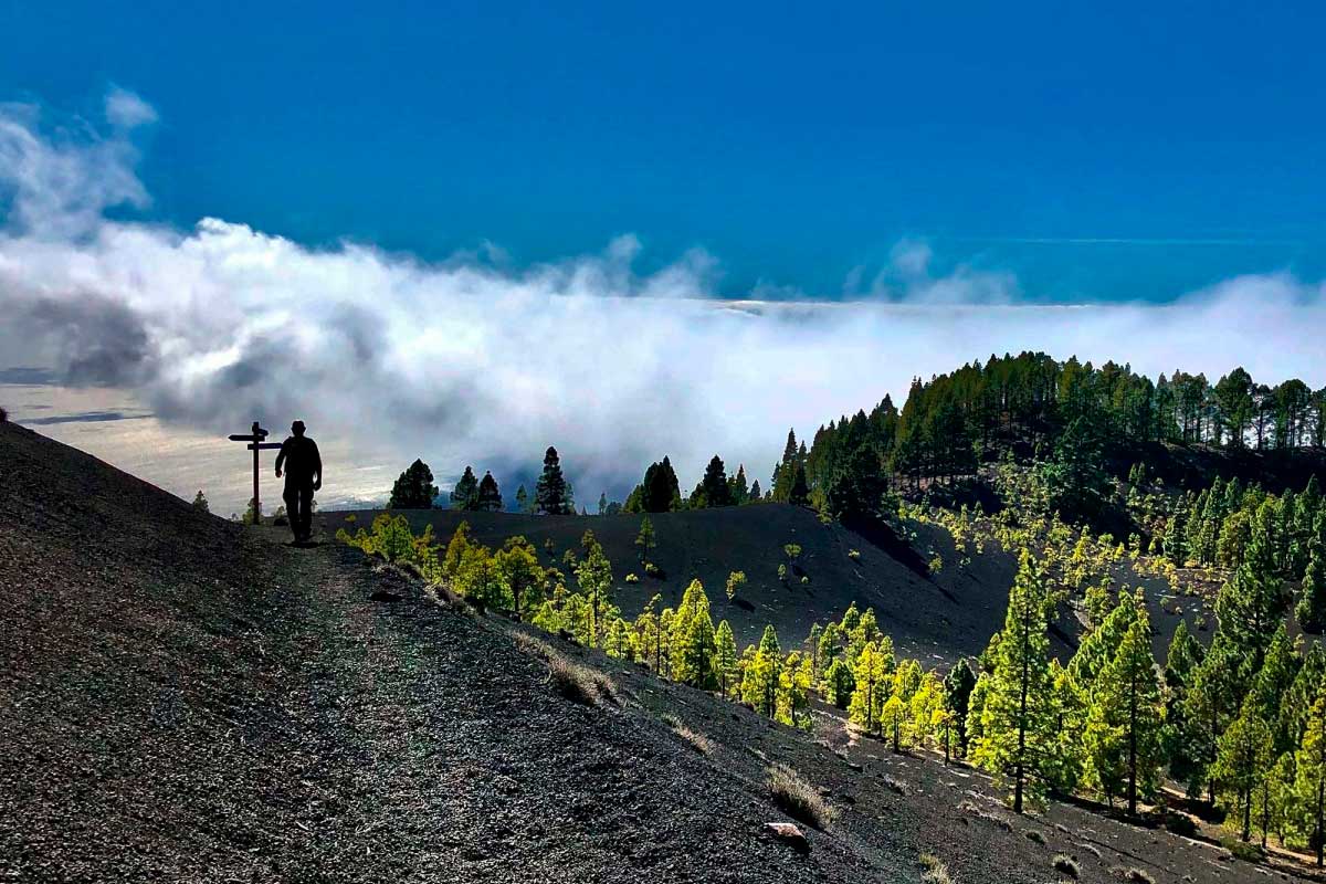
Today our driver will take you back to the Refugio del Pilar to start the second stage of the GR131. The path continues gently along the Cumbre Nueva in the direction of Roque de Los Muchachos. But from El Reventón begins a vertiginous ascent along the edge of the enormous crater of La Caldera. After passing the Pico de Las Ovejas, the trail begins to progress westwards, cresting the crater and leaving behind the Punta de Los Roques Refuge, the Pico de La Nieve and the Pico de La Cruz. Return to the hotel from Roque de Los Muchachos.
21 km | +1583 m / -765 m
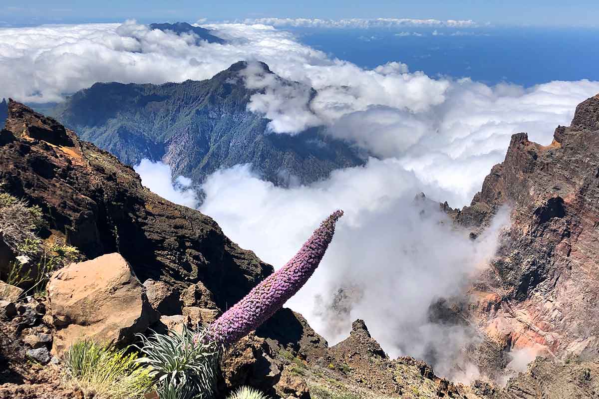
3rd Stage
 From Pico de la Cruz to Puerto de Tazacorte
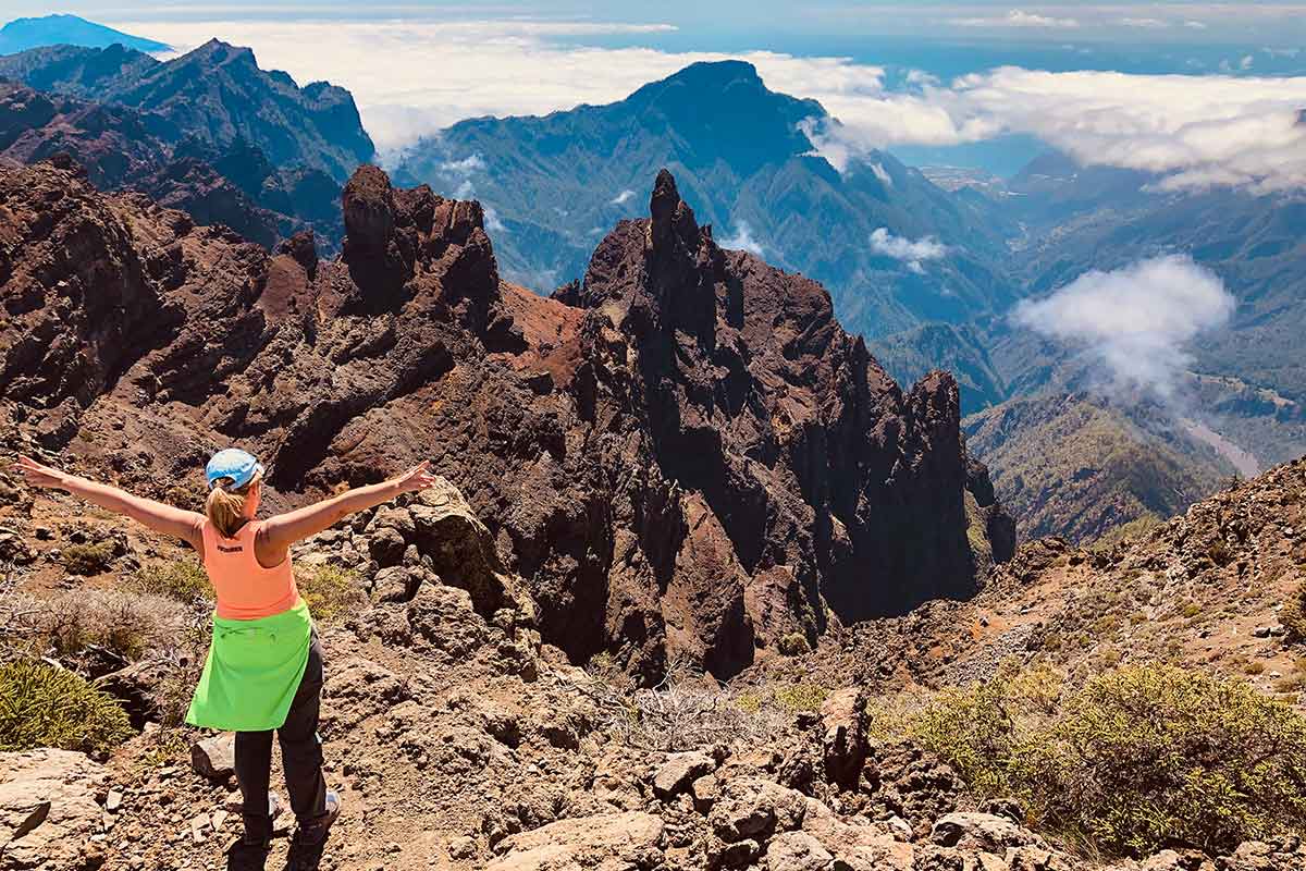
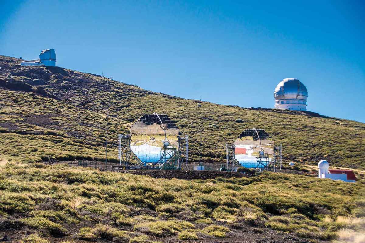
Return to Pico de la Cruz. Shortly before reaching the Roque de Los Muchachos, situated 2,426 metres above sea level, you will cross the various astrophysical observatories that bear its name at the highest point of the island and continue on a permanent descent to the sea. From the top, spectacular views of La Caldera and other islands of the archipelago follow one after the other. After plunging into the pine forests of the west, you will reach the Torre del Time, 1160 metres above the sea, from where you can enjoy an amazing view of the entire Aridane Valley and the gorge that makes up the Las Angustias ravine. The GR131 continues its relentless descent through the Mirador del Time viewpoint until it reaches Puerto de Tazacorte. There, a refreshing swim in the sea awaits you before you return to your accommodation by regular bus.
22,2 km | +666 m / -2975 m
TOUR LOCATION
The most demanding route on La Palma is the The Walking Stick Route. With a distance of more than 65 km, the route can be tackled in 3 stages, although good physical condition is required. And each stage ends at one of the most significant points on the island. Undoubtedly, a unique experience for a route full of unforgettable moments.

PRICES / SERVICES
- Price from: 175 € per person
- The price includes:
- 3 Walking routes
- Taxi and public bus transfers
- Descriptive brochures for each stage
- GPX Tracks to follow each stage on your mobile device