20 Oct Volcanoes on La Palma
Volcanoes on La Palma
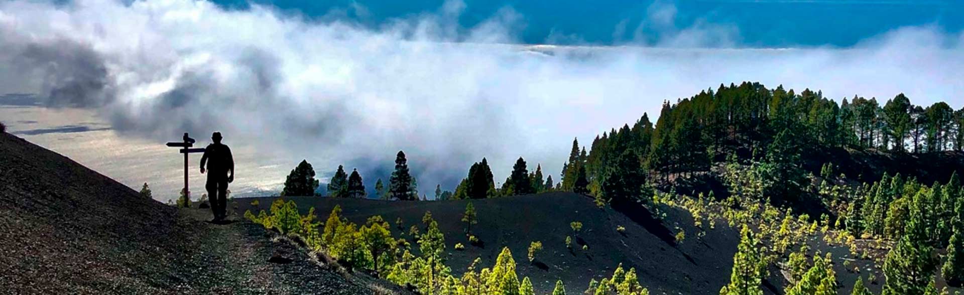
The Star Tour on La Palma, la Isla Bonita, is the Volcano-Route on La Palma. This tour starts at the Refugio del Pilar, on 1450 m. An area with enormous pine trees and centenarian cedars situated in the center of the island. From there the GR131 follows to the south on the edge of the mountain range named Volano-Route. Towards the north the crater of the Caldera de Taburiente offers imposing views to its interior. In this part of the island different volcanic eruptions have taken place in the last 500 years. The Volcano-Route only is to make by walking. It is about a 18 km long tour which ends in the village of Fuencaliente on 700 m. But if you still have energy you can follow about 6 km more constantly descending until reaching the lighthouse of Fuencaliente, close to the sea. The main millestones of this tour are:
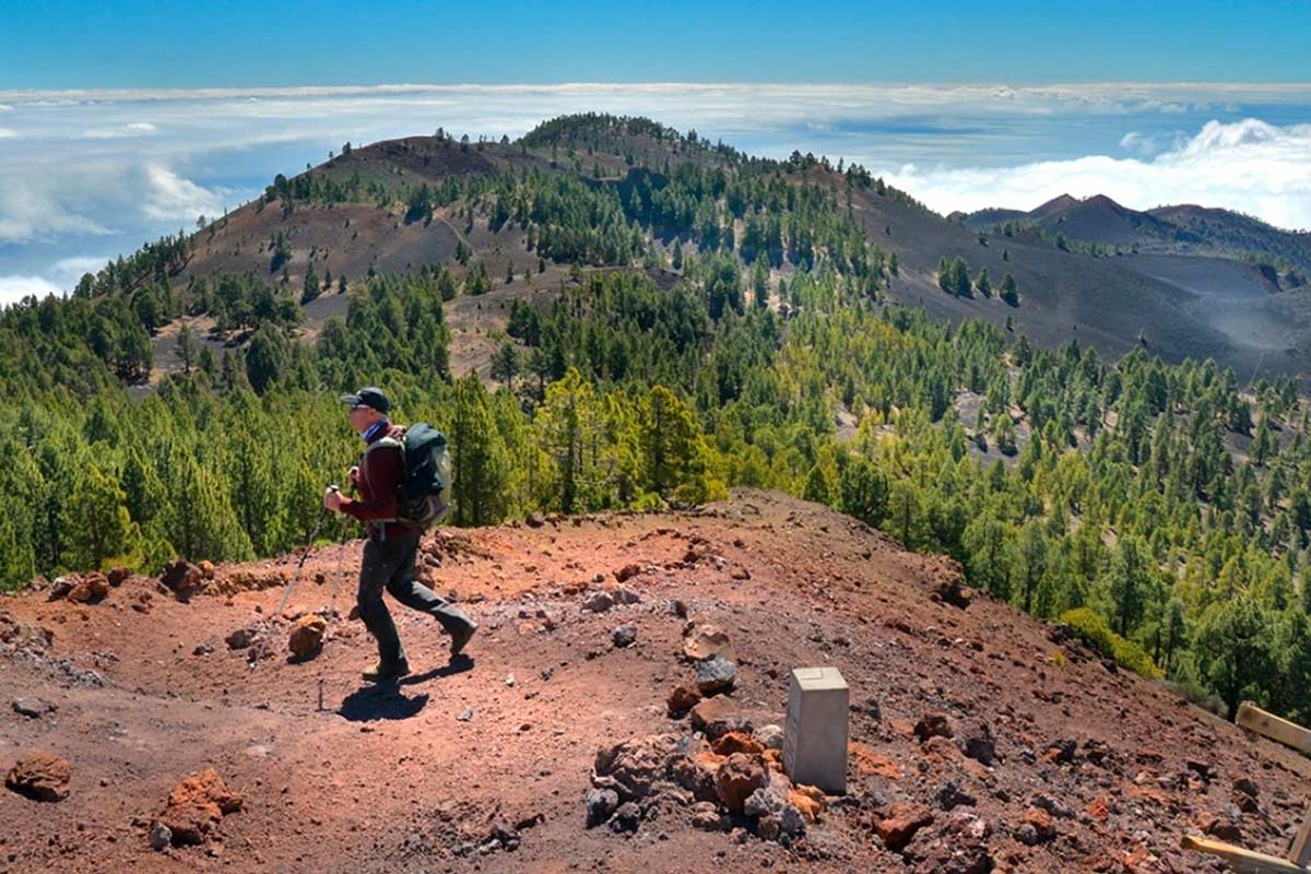
Birigoyo Peak
After start walking we will see a peak rising up until 1800 meters. It is the Birigoyo Peak which marks us the start of the Volcano-Route of La Palma. The Birigoyo Peak is an old crater which you can climb up or bypass, following our tour towards the south. The ascent is quiet steep and add an additional run which you should consider before. The views on the top of the Birigoyo are absolutely spectacular. The summit with its waterfall of clouds, the altiplano of El Paso and the Aridane Valley, the Caldera de Taburiente and its circle of summits with the highest point on the Roque de Los Muchachos… All of them make up the Volcao Route on La Palma.
Volcano San Juan
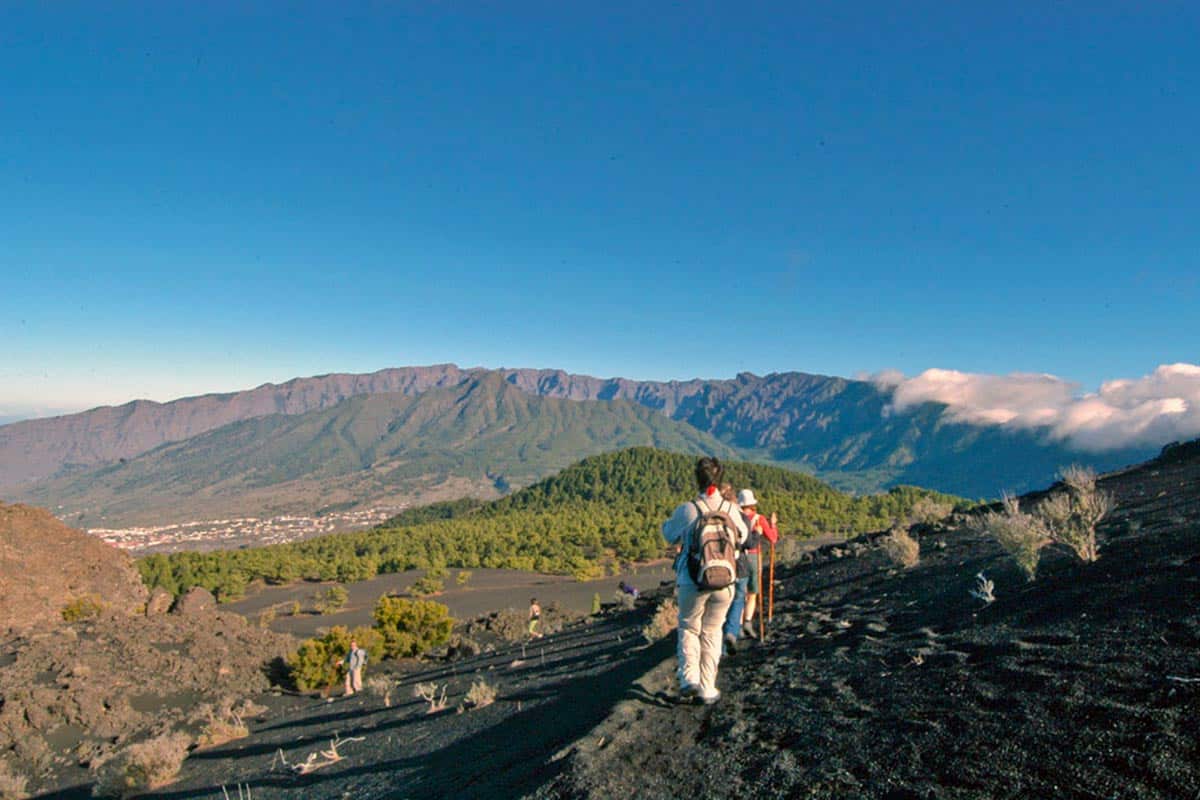
The most spectacular eruption of all was, without doubt, the one of the Volcano San Juan. The eruption started the 23.06.1949 and still many local people remember this event. The eruption caused two enormous crater: Durazno Crater and Hoyo Negro. The clouds of volcanic ashes were depositated on lapilli dunes, today called “Llanos de Jable”. The volcano San Juan extended the island on the west part of the island enlarging La Palma for about 4 square km in the area of La Bombilla. New land for banana cultivation was created. The lava flow followed to the west and demolished houses and hamlets. Still nowadays the petrified lava flow is visible, crossing the main road at different points.
The crater of Nambroque
Leaving behind the volcano San Juan we follow our ascent on the Volano-Route. After a while the waymarks indicate to visit the Volcano Nambroque. You would have to leave the path, but it repays a little interruption. The Nambroque is situated on the eastern part of La Palma and it is a perfect viewing point, if it is not cloudy. It´s about an old volcanic cone of small size but located at high altitude from where you can observe the whole eastern part of La Palma.
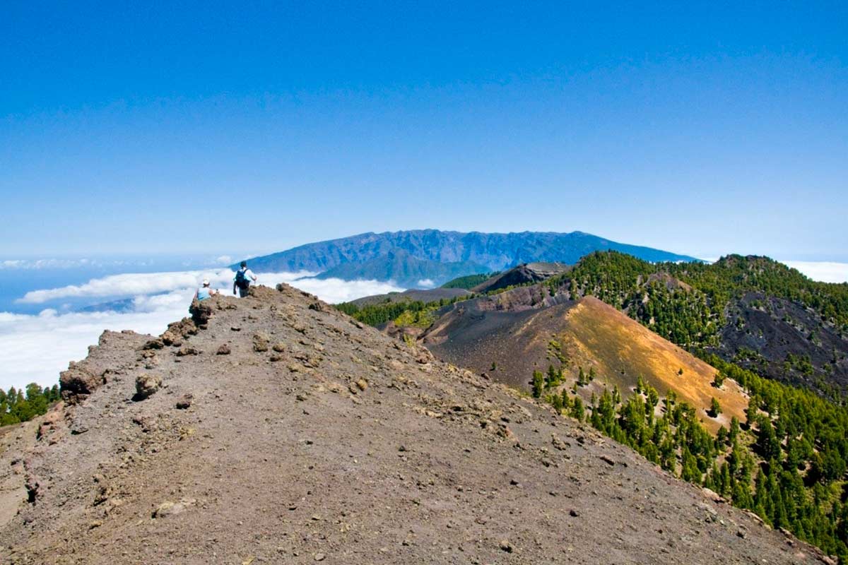
Las Deseadas
Las Deseadas – two interesting twin crater located on the highest point of the Volcano-Route. From this point you get a bird´s-eye view of La Palma.Towards the north the Caldera de Taburiente, towards the east the Peak of the Teide on Tenerife, to the south the island of El Hierro. You can also observe the extreme topography with almost vertical falls from 2000 meters down to the sea. The curious name of Las Deseadas has different interpretations. When we reach this point we have half of the route done already. Due to its altitude (1978 m) vegetation does not exist and the climate could be extreme. It is essential to have appropriate warm clothing.
Mountain El Cabrito
Leaving behind the Deseadas we will start the descent on our path padded of volcanic sand and pine needles. Now the path is running through an open gauge like firebreaks. And we can observe the dark pine barks, blackened by the successive fires. Further on, on our left, the mountain El Cabrito rises up. It´s a bout an old volcano, nowadays totally covered with vegetation.
Volcanoes on La Palma: the Canary Pine Tree
The canary pine tree is the most succesfull plant species on La Palma and on the Canary Islands. It´s about a type of tree totally adapted to the power of the island. It is able to resist the high temperature of forest fires after an eruption. Furthermore, the pine tree is extremely dominant. Its needles cover the whole bottom of the pine forest and prevent other species to flourish. Only the fire, burning this blanket of needles, acts as fertilizer and clears the field for other plants to grow again. Today they use the needles in the banana plantations as vegetal coverage. It is not rare to see full loaded trucks transporting it to the coast where bananas are growing.
Volcano Martin
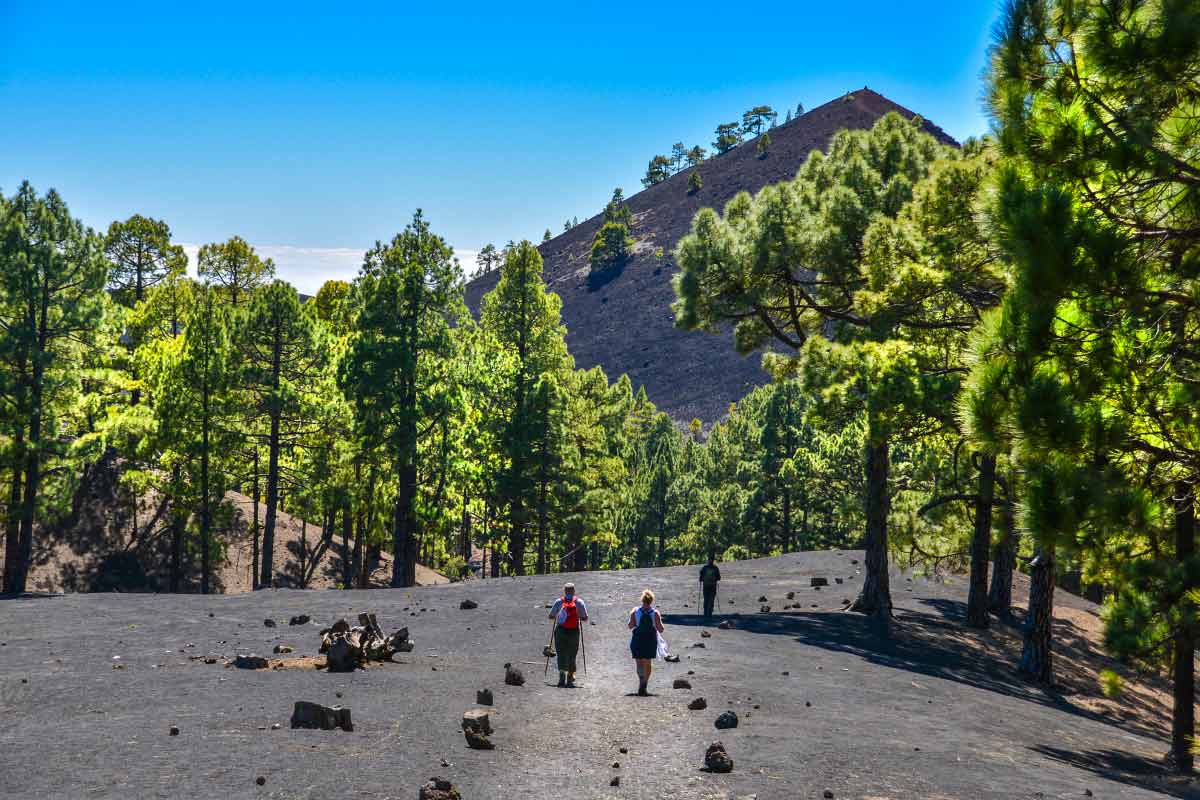
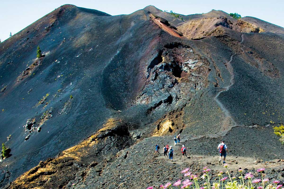
The Volcano Martín, rising up to 1500 meters, possibly one of the most spectacular volcanoes of the Volcano-Route f La Palma. With strong red colours located in the green canary pine forest, the volcano Martín is the last crater which appears before we reach Fuencaliente. Also this volcano made its contribution, enlarging the island about 1 km on the southeastern part. Nowadays you can see the lava stream falling down to the sea passing the municipality of Montes de Luna. The volcano Martín had its eruption in november 1646. It was a loud and explosive eruption. The bombings were heard from the neighbouring island Tenerife. The inter-island council, believing that La Palma was been attacked, came with an army to defend the islands from pirats.
The pine forests of the south and he volcanoes of La Palma
Leaving behind the Martín Volcano the GR131 descends constantly and goes through the pine forests of the south until reaching the village of Fuencaliente. These are the two last hours of the trip. Inside of the pine forest you are not enjoying anymore the panoramic views but the freshness of the shadow. The Volcano Route is coming to its end and we are already thinking in the fresh final bear. Fuencaliente has an iconic place to finish this trip. It is the Bar Parada, situated at the main road. There you can have a glass of bear or wine and the typical almond cookies (“almendrados”) and discuss about the trip.
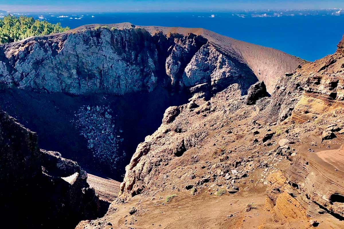
Volcano San Antonio
If you still have energy you can pass by the Volcano San Antonio, just at the foot of Fuencaliente, around 1 km walking. The San Antonio has erupted in 1677. It is a perfect crater, on its edge you can walk around. There is a information center with interesting descriptions and graphic documents. The town council of Fuencaliente has understood its touristic attraction and its economic potential. For about a few years the access to the crater is subject to a fee.
The Volcano Teneguía and the lighthouse of Fuencaliente
The ones who still have energy and 18 km is no great matter can follow the Volcano Route of La Palma on its final stretch until reaching the sea. After visiting the volcano San Antonio the GR 131 follows descending the whole time until reaching the last volcano of the Canary Islands: The Teneguía Volcano. Its eruption at 1971 was filmed and documented. It razed many vieyards and houses and extended the island by 2 square km on the southern part. The eruption of the Teneguía took nearly 1 month and created an impressive landscape of apocalyptic look. The Teneguía Volcano rises to a bit more than 300 meters and represents the final stretch of the GR 131 running on the Volcano Route of La Palma. The path ends close to the lighthouse of Fuencaliente and its salt pans. Nowadays a modern restaurant permits to recover from the efforts and wait for the next bus to come back to the place of origin.
To walk the Volcano Route on La Palma
Reserve your trip on our web site. Don´t miss it!! Nevertheless it is very important to control the weather situation; you can check the AEMET forecast.